By Dale Hurd
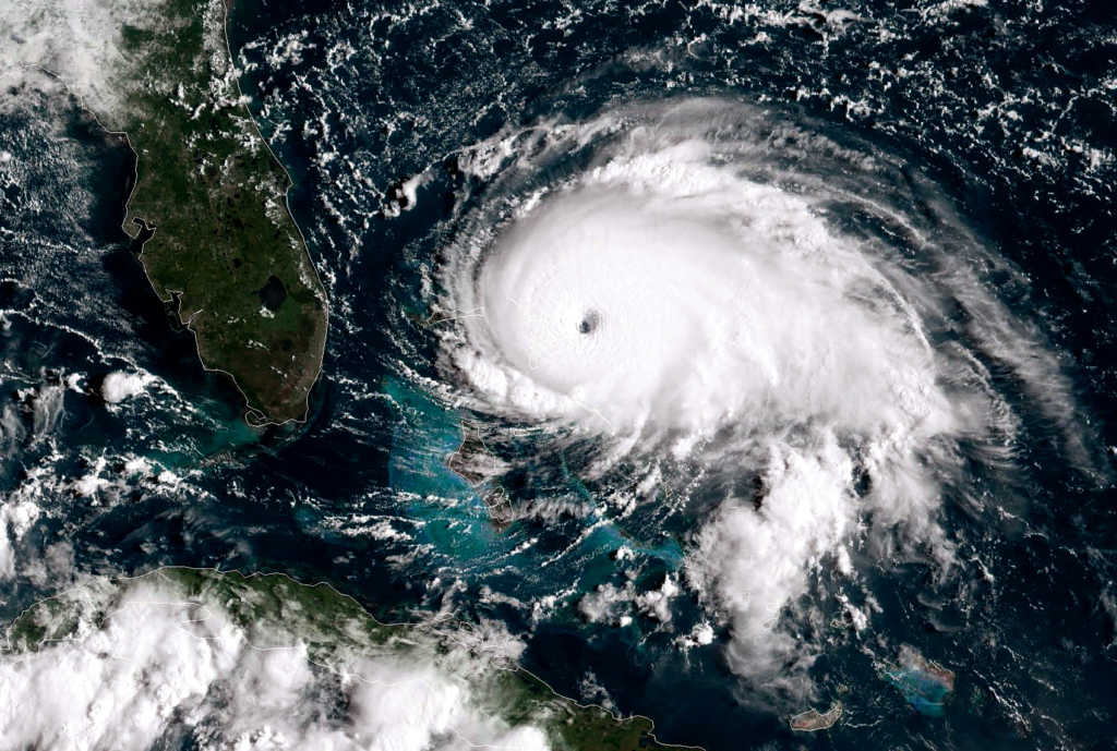
“Complete devastation” were the words of the man who shot some some of the first video this morning from the Bahamas, which showed the results of 185 mph maximum sustained winds and gusts up to 220 mph, tying the record for the most powerful Atlantic hurricane to ever make landfall.
Silbert Mills, owner of the Bahamas Christian Network said the damage was, “Like nothing I have never been through. It really feels like you are helpless and that you have to depend solely on the mercy of the good Lord who has full control over nature and the elements of nature we can never understand.”
The Bahamian Prime Minister, Dr. Hubert Alexander Minnis, called Sunday “the saddest and worst day,” tweeting, “We are facing a hurricane that we have never seen in The Bahamas. Please pray for us.”
As the strongest hurricane on record to strike the region, Dorian is now inching towards the Florida coastline.
President Trump, visiting FEMA headquarters Sunday, said, “The Category 5 or something that I don’t know that I’ve ever even heard the term other than I know it’s there that’s the ultimate and that’s what we have unfortunately.”
The slow-moving hurricane is expected to turn north and begin a week-long torrent of wind and rain on the southeast coast. South Carolina’s governor has ordered evacuations along the coast, and both South and North Carolina have declared states of emergency.
Acting FEMA Administrator Pete Gaynor said Americans need to pay attention to this storm. “Don’t dismiss this storm, we are not out of it, life threatening dangerous surge, water, wind, it’s coming your way. Take time to prepare, you and your family,” he said.
Florida Sen. Rick Scott says his worry is that Floridians will think they’re off the hook.
“We’re gonna get storm surge, we’re gonna get a lot a rain, the closer it gets to Florida we’re gonna get more rain that can cause flooding, so take it seriously. Over-prepare, don’t under-prepare,” Scott said.
Some people are heeding the warning, beginning to evacuate their homes and stocking up on gas and supplies of food and water.
The latest predictions indicate the storm will likely stay about 40-50 miles off the Florida coast, but forecasters say a slight shift in track could bring it onshore.


